In 2015 my wife and I embarked on a trip to Mount Rainier in the Cascade range of Washington State. We had been to Rainier (aka Tahoma, The Mountain) many times before. My wife had worked at Paradise Inn at 21 years old, and she had traveled back for various adventures on the Mountain in the ensuing years. I had also spent a considerable time on Rainier, hiking the flowered meadows from Paradise, and up the snow fields to Camp Muir. I had attempted to Summit Rainier twice in the Winter, only to be scuttled on my first attempt above Camp Hazard in the ice chutes just below the Kautz glacier, due to a climbing partners equipment troubles. My second attempt failed 2000 feet above Camp Muir on a moonlit night to due to elevation sickness and general disorientation.
This active volcano and its diverse surroundings always call us back, so we both returned to complete the famous circumnavigation of the Mountain on the Wonderland Trail.
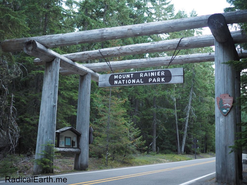
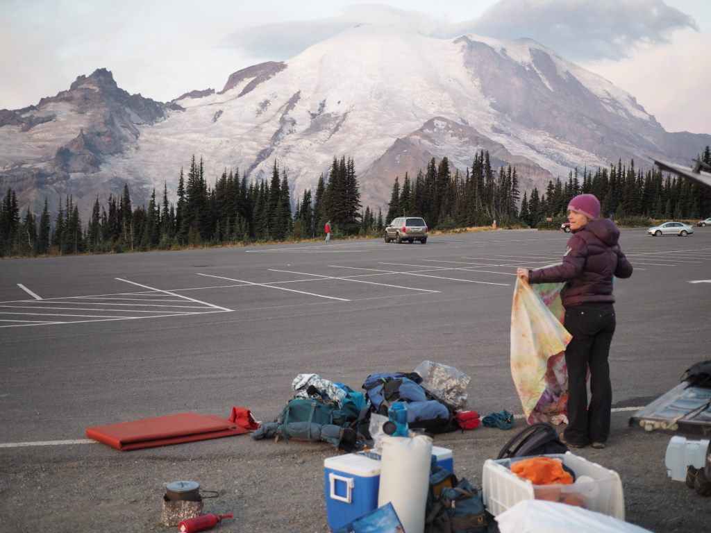
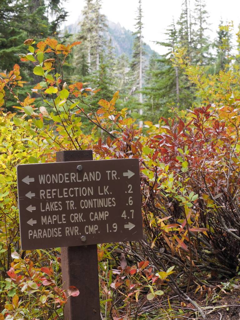
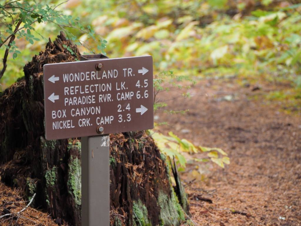
First challenge: Get a permit! There is plenty of paperwork and planning to do for a 93 mile wilderness hike, with 3000 ft. elevation gains and losses and 10 miles of hiking each day being the norm. We put in for our permits months in advance, and ended up NOT getting our permit. Disappointing but not a huge surprise. The Wonderland received nearly 3000 permit requests that year, and the Park can only accommodate under half of that over the short Summer season. Instead of tossing in the towel, we decided to take the drive from Idaho and cross our fingers for a walk-up permit at Longmire Ranger station. To our delight, we were able to get a permit! 10 days, 9 nights hiking counter-clockwise, starting at Sunrise trail head. Our planned selection of some campsites shifted, though we still went counter-clockwise as hoped for.

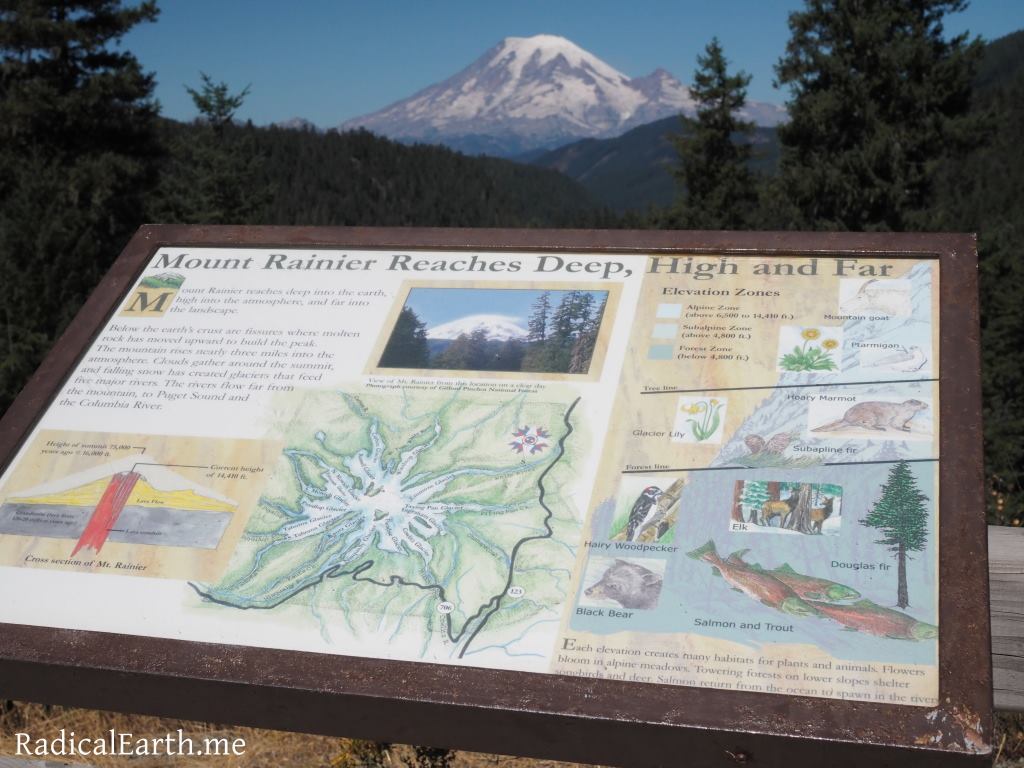

Planning, planning, planning. Maps, Maps, Maps. Prepare, prepare,prepare.
We utilized the Mountaineers “Hiking The Wonderland Trail” as our primary professional guide book. N.S.P.S. topographic / key information maps were also purchased and very useful. I downloaded the Forest Service quad maps on Gaia to utilize as needed with my phone and the app. My phone was off most of the time to conserve battery, and mostly we utilized the actual printed maps we had.
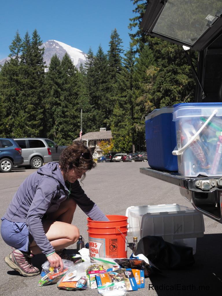
We drove through the day and arrived at the Mountain with just enough time to check in, get our permits, organize our Longmire food cache, and make it half-way around the mountain to the Carbon river ranger station. At Carbon river we organized another food cache that the Rangers would then take to the Mowich campground food cache inside the park.
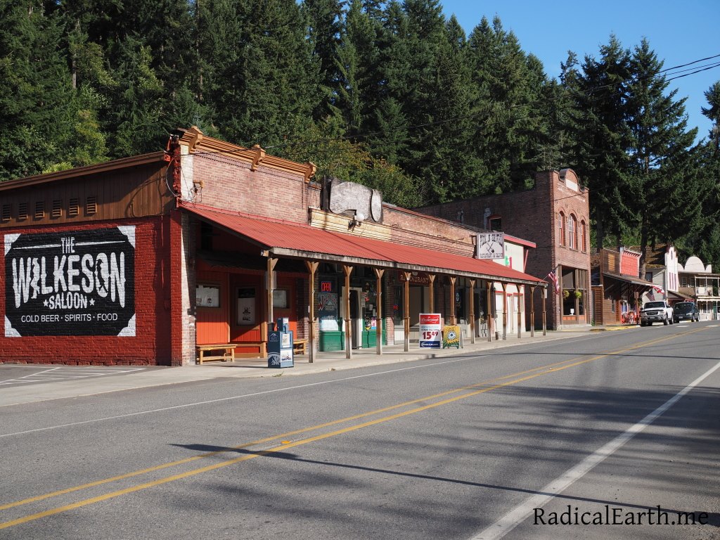
The tiny hamlet of Wilkeson just before the road to the Carbon river ranger station. Good place to get a six pack of craft beer!
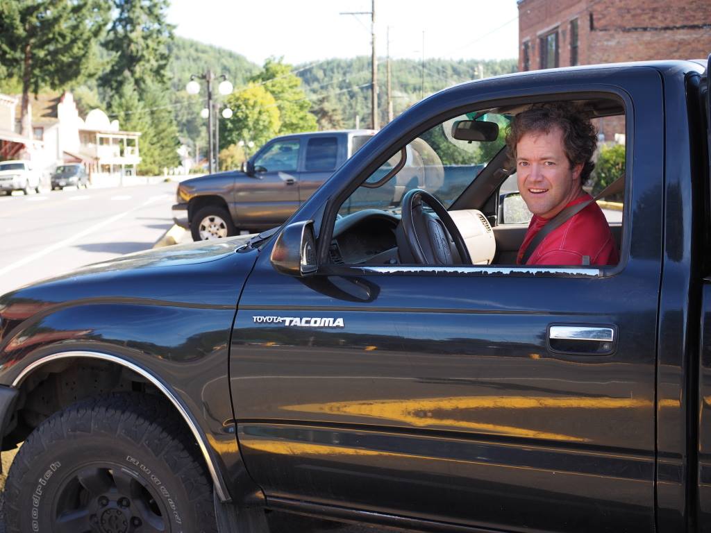
Our little 2000 Yota was the perfect 4×4 go- cart to take us from Idaho to Rainier.
Once we dropped our food cache off at the Carbon river we made the long trek to the White River entrance of the Park.
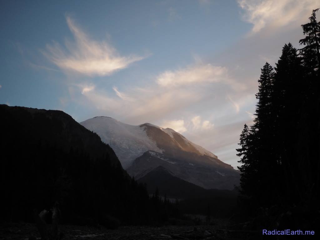
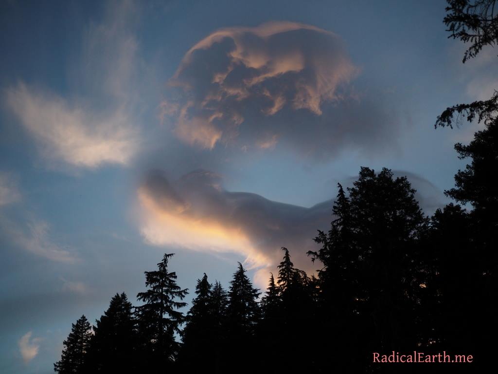
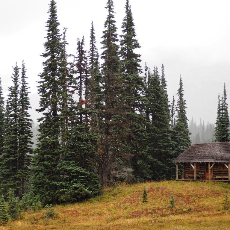
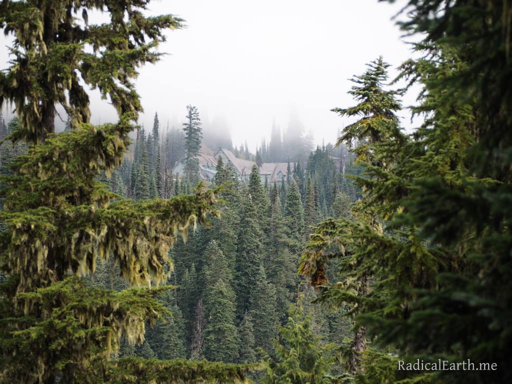
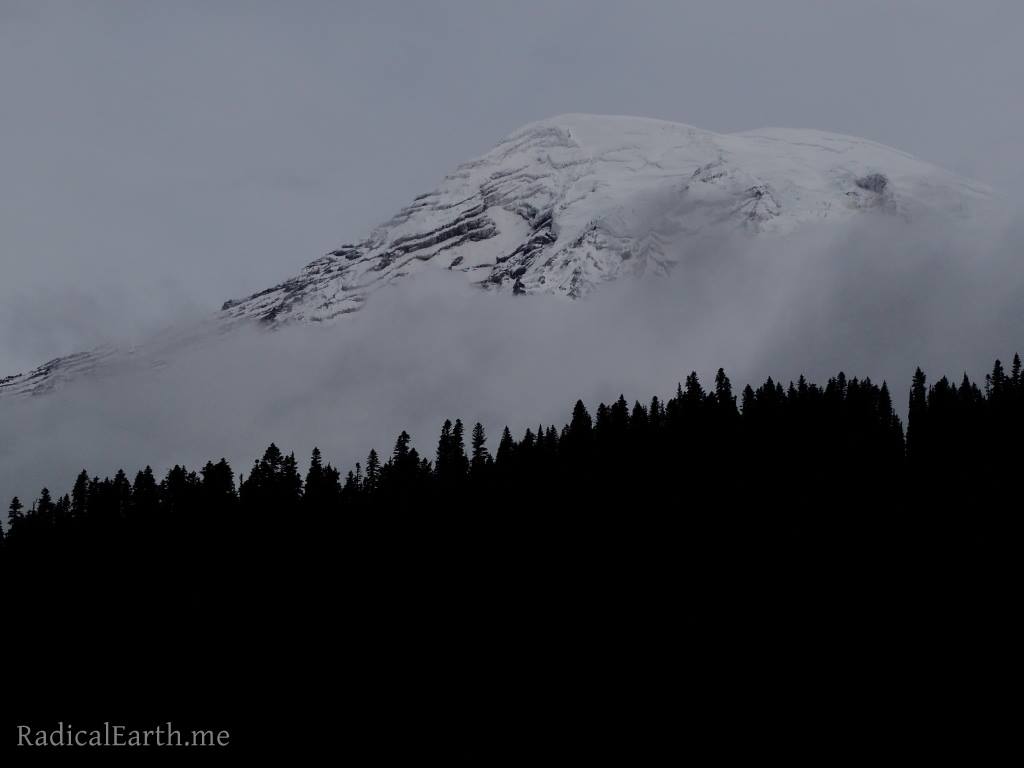
The campground at White River was busy but we were able to get a nice spot, set up our tent, have a little campfire and enjoy a special sunset right on the river with views of the Mountain. Clouds were gathering on the summit and peeling off in our direction, creating some wonderful sights as seen above.
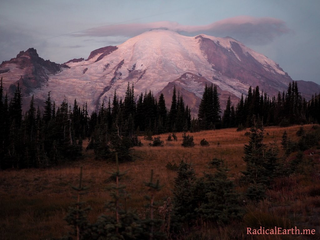
From the White River campground we broke camp and made our way to Sunrise ranger station in the dark of the early morning. To our absolute delight we were treated with the quintessential early morning view at the aptly named Sunrise visitor and ranger station. The Mountain showed itself in all of its pink morning glory. We made sure to take in as much as we could, but we had a long 12.5 mile hike ahead, and final packing to do.

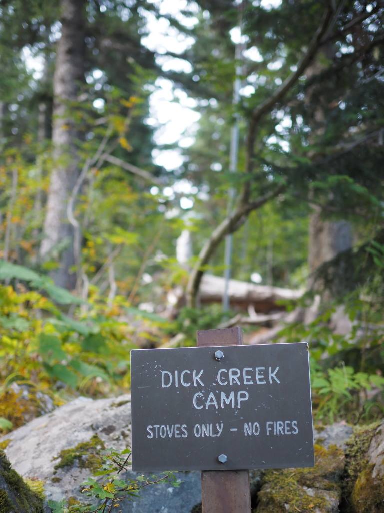
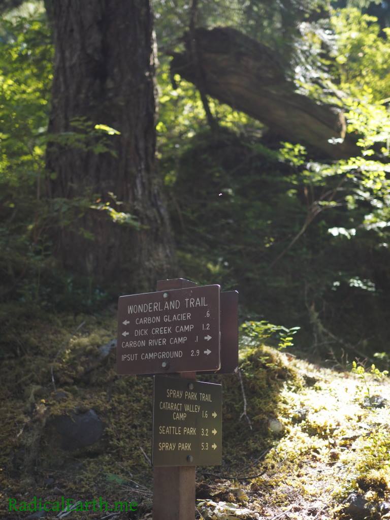
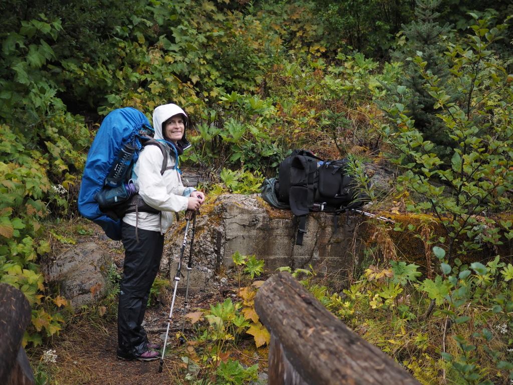
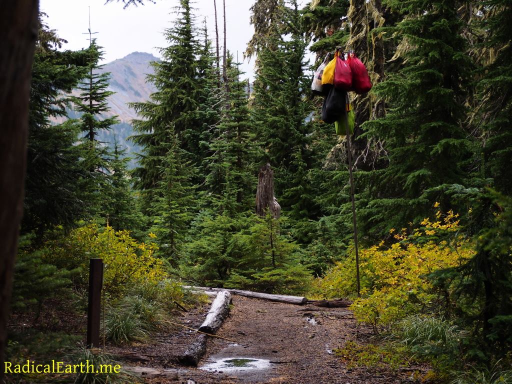
Final checks on backpacks complete, Yota locked up, pink and peach skies turning to blue, we officially embarked on our first day of hiking. End of the day destination being Dick creek campground.
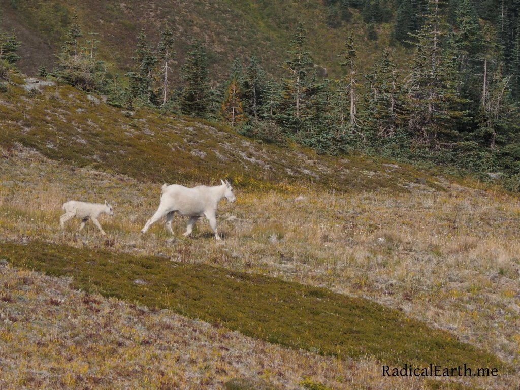
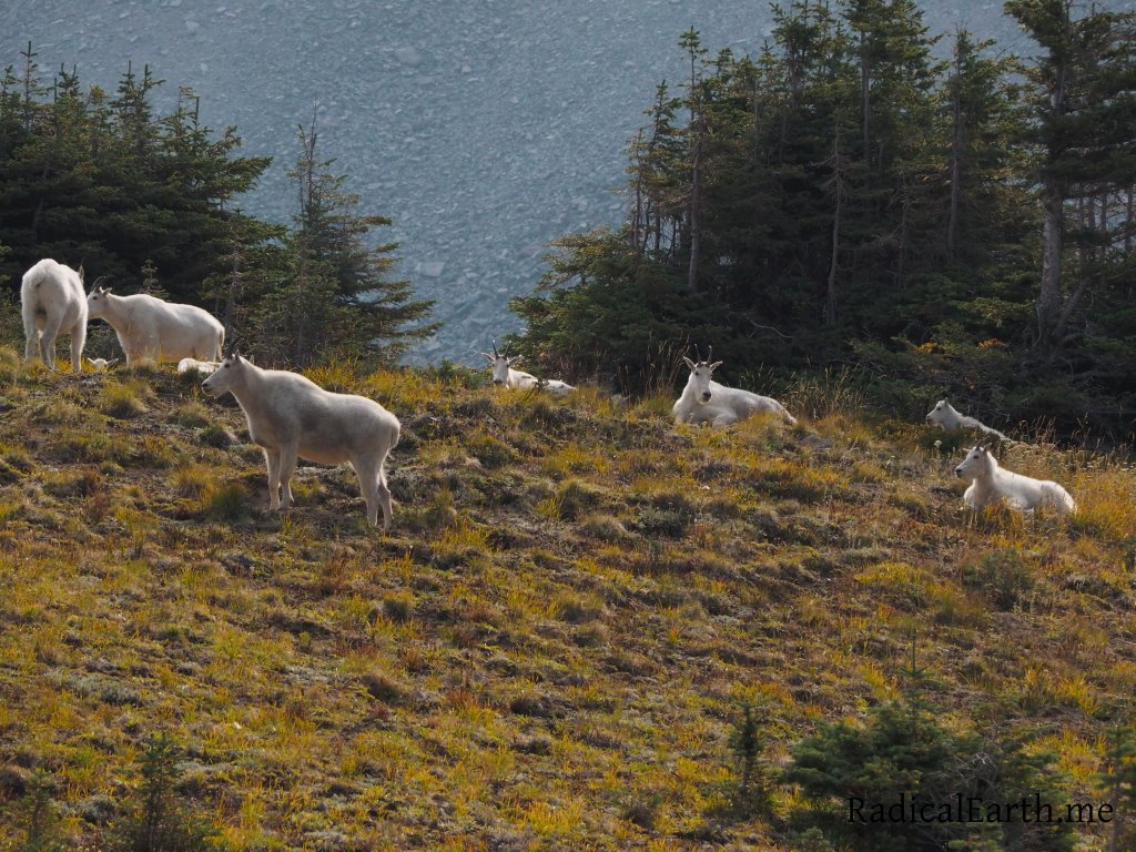
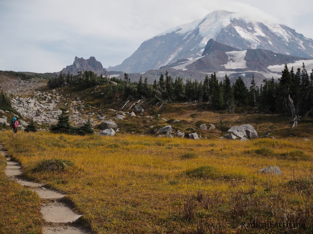
It is not unheard of to spend an entire week at Rainier and never see the Mountain, as it is often cloaked behind thick cloud formations. This was not to be our fate. Breathtaking sunrise views were replaced with the sweeping scenes of Berkeley Park, including an impressive tribe of mountain goats with a few kids to boot!
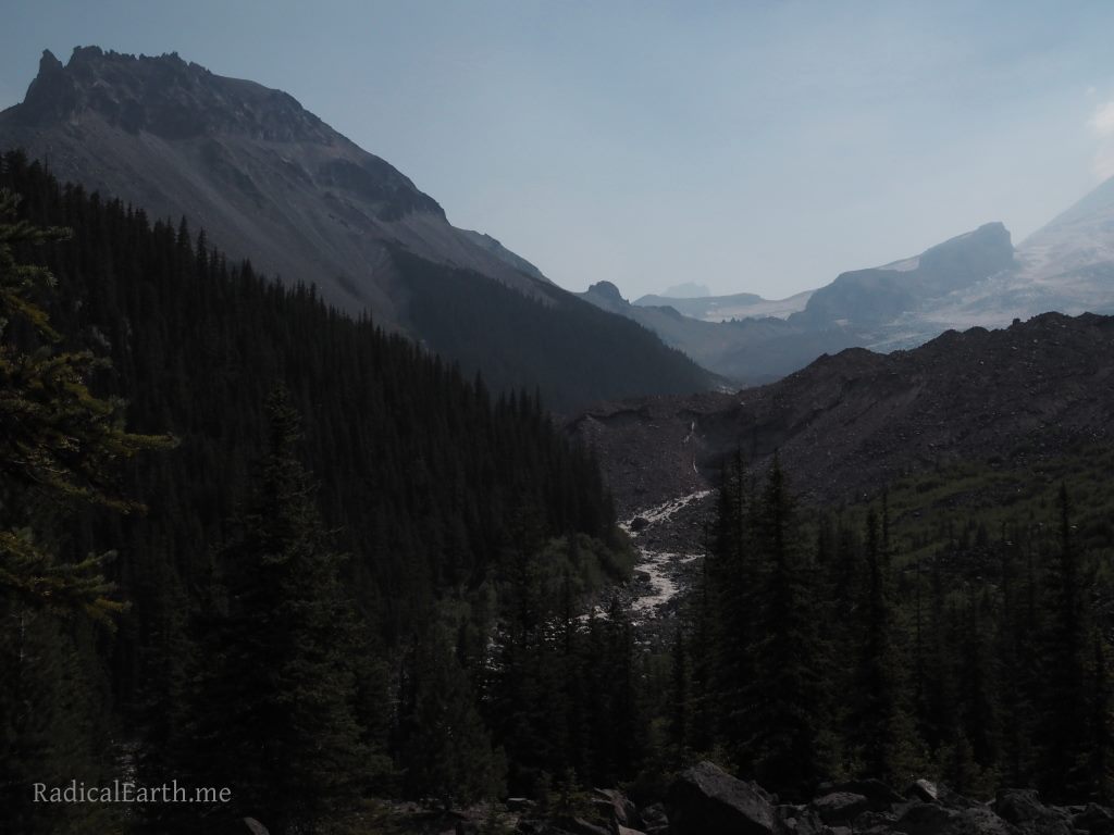

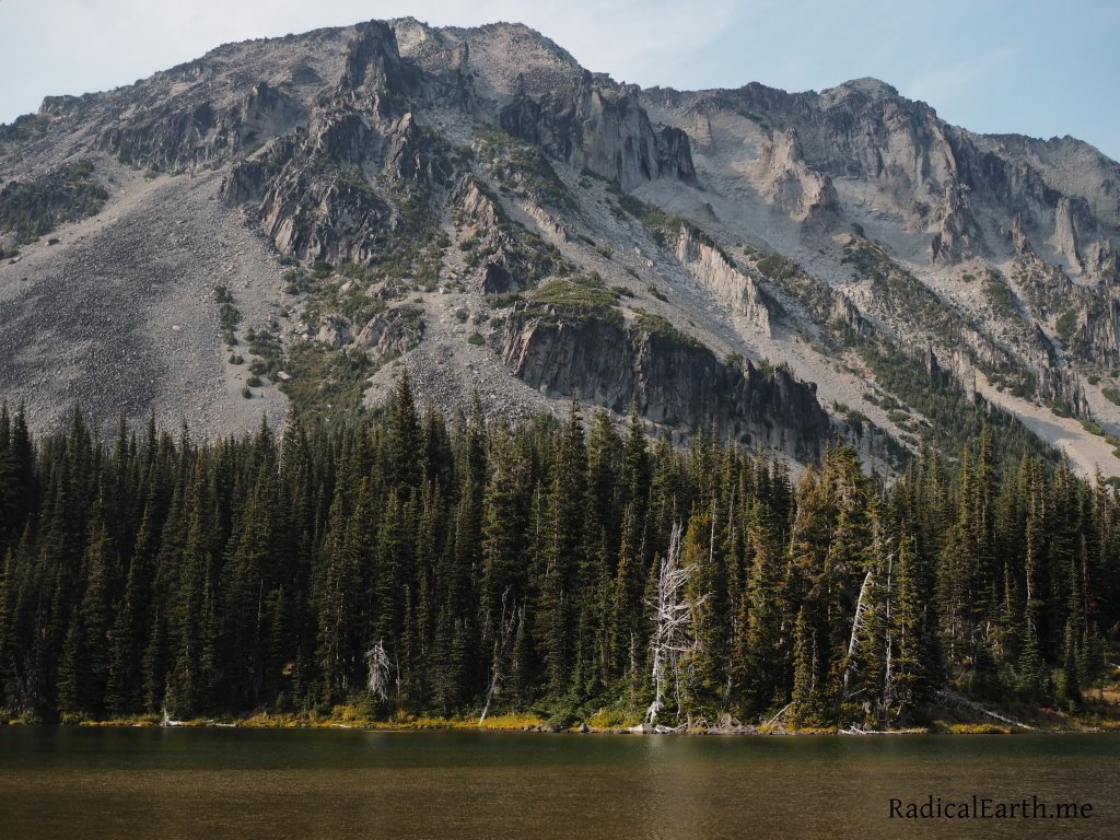

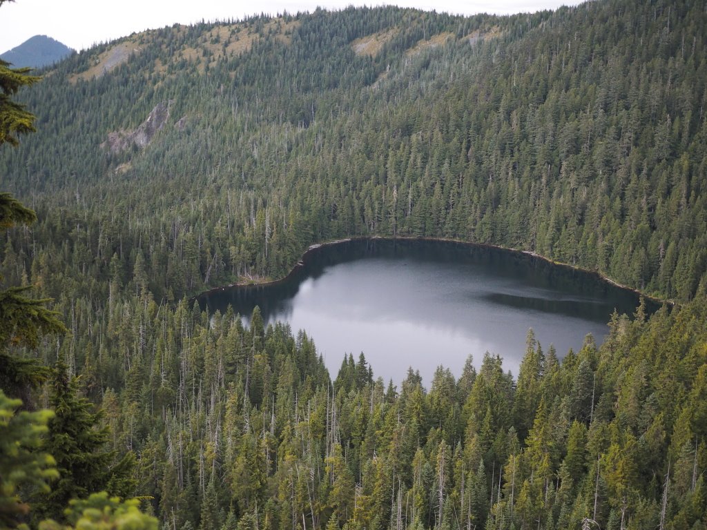
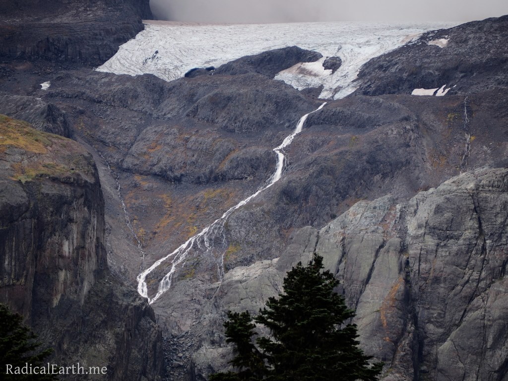
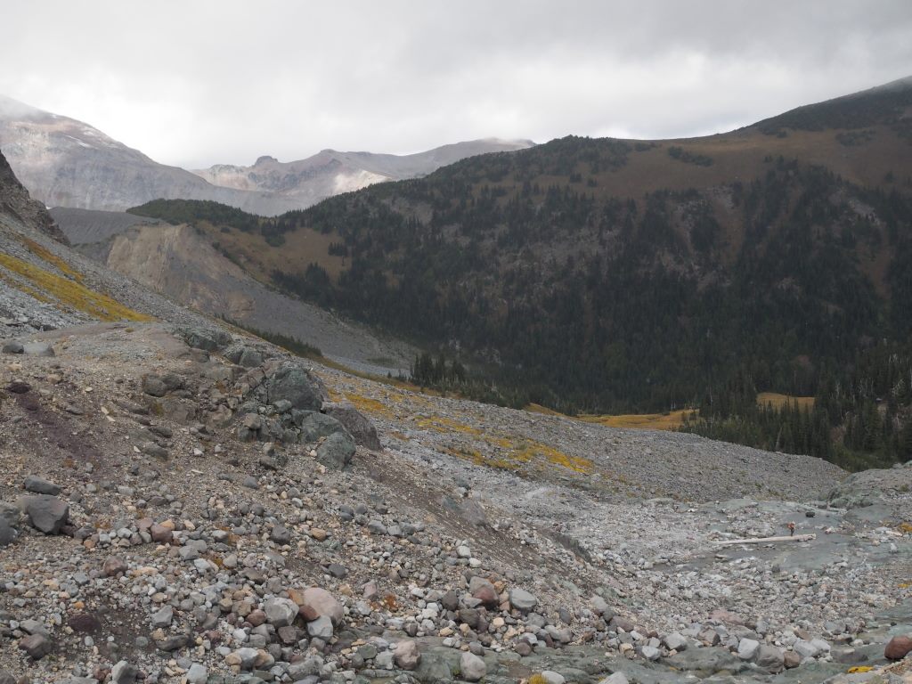
The adrenaline coursing through us since we woke up, started to wear off once we crossed Winthrop creek, and the weight of our packs and the miles ahead started to bark at our feet and muscles. Mystic lake (our originally intended first night camp) offered up a wonderful spot to take an extended break and rest our feet. Only 3.6 miles to go! Turns out, even though it was mostly downhill, the last push to Dick Creek camp was a bit of a burner. Good thing we had absolutely stunning views up the Carbon Glacier, and one particularly breath taking view of a raging waterfall far up the glacier canyon plunging straight out of the high glacier hundreds of feet down disappearing back into the glacier below.
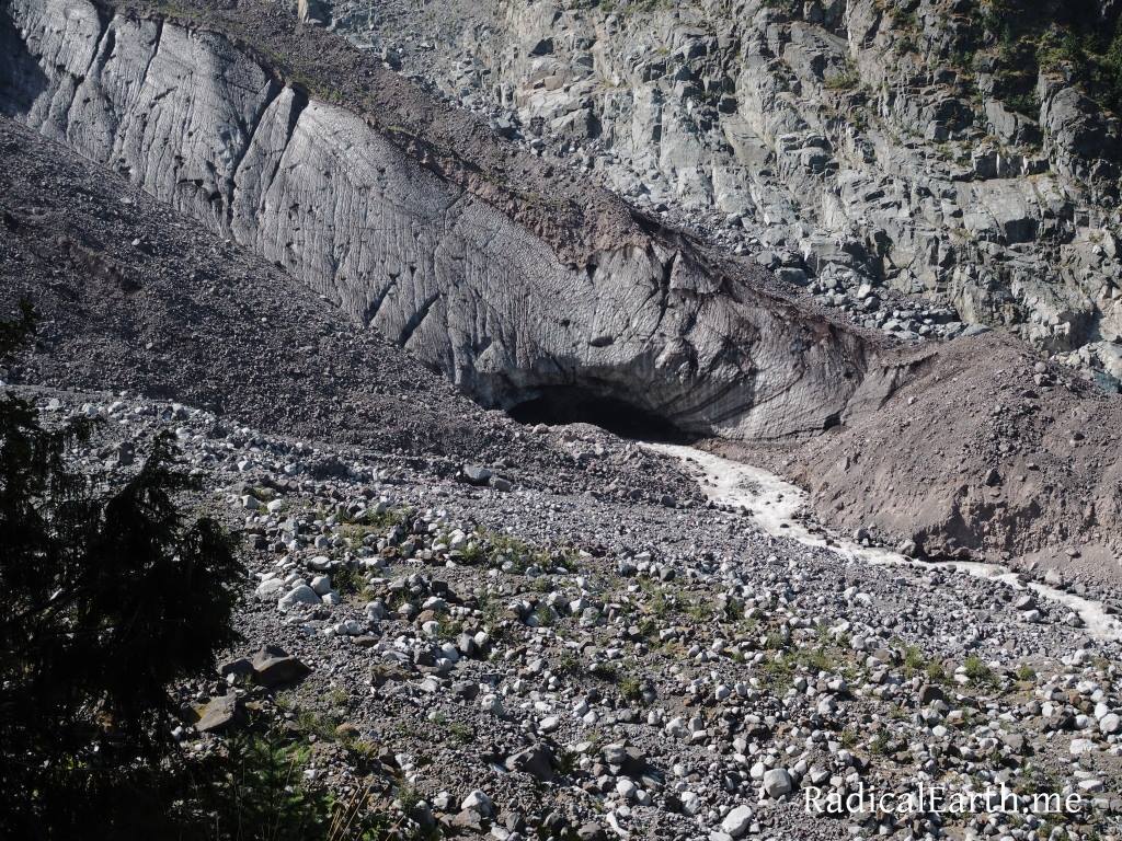

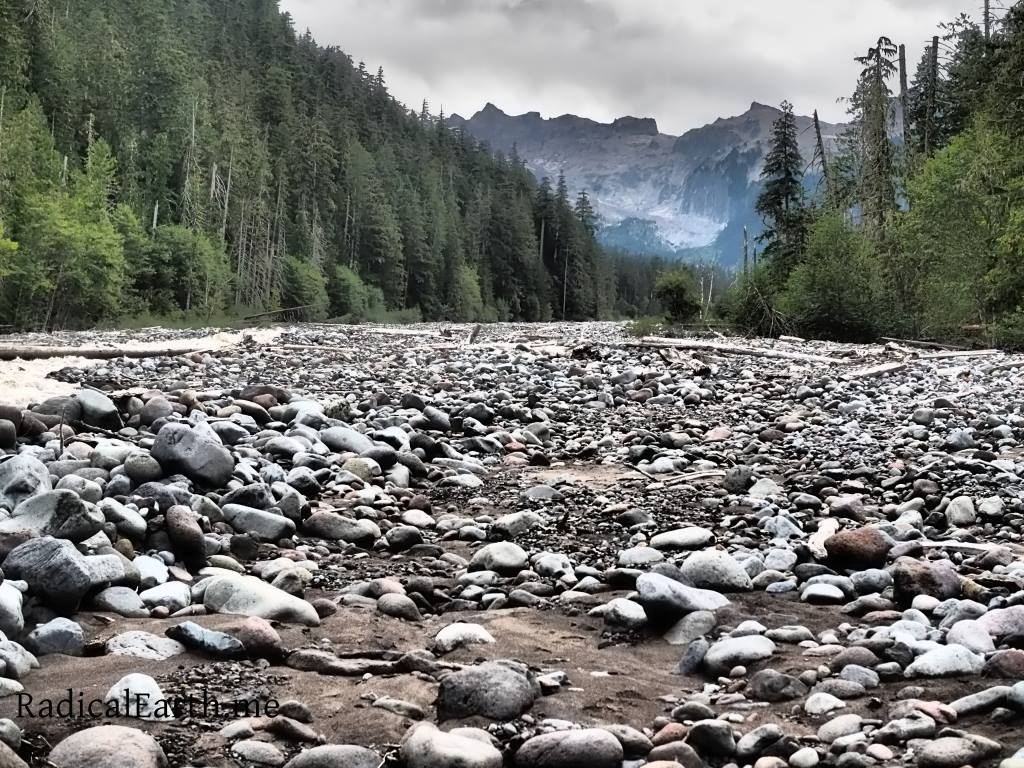
Day 2 would take us down to the Carbon river suspension bridge. Before we arrived there we were afforded massive views up the Carbon Glacier valley, and into the toe of the glacier itself, where the Carbon river rages from deep within the 700 foot thick Glacier. The Carbon glacier is the longest glacier in the lower 48 States and the lowest elevation glacier in the contiguous United States. Smoky haze from large wildfires burning in Eastern Washington started to push in from the North and East.
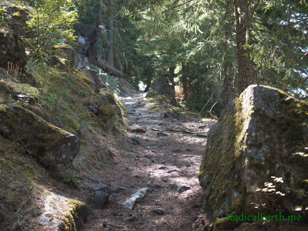

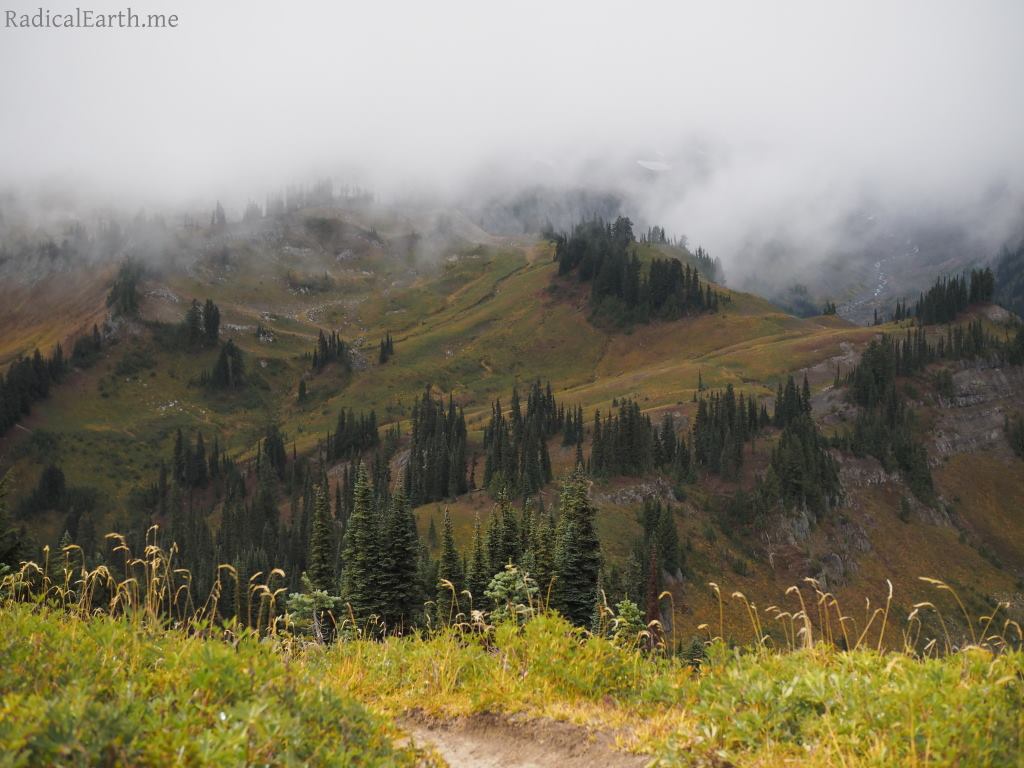
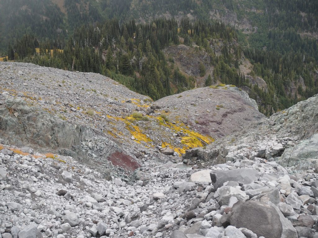
Our route to the day 2 camp destination of Eagles Roost campsite was no slouch of a hike even though the total mileage was 3.5 miles less than the previous day. From the Carbon river suspension bridge we chose the alternate route through Spray Park. The bridge on the Carbon river to the top of Spray Park is a 4000 vertical foot climb in a little under 4 miles. Starting in old growth forest like every basin in the Park, the trail quickly ascends into dreamy sub-alpine terrain, and eventually tops out above tree line on a rocky, wind and snow scoured piece of ground. Hikers are warned that the trail can be easily lost in Summer snow storms, or even just thick fog. Large cairns have been established to help keep hikers on track.

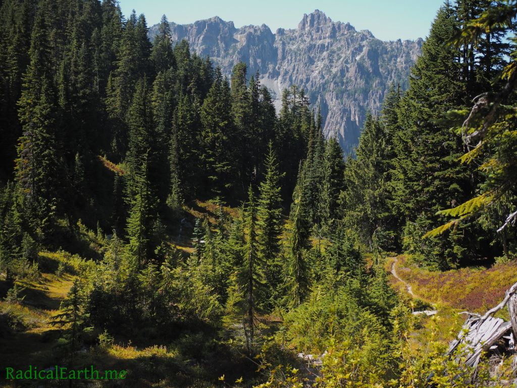
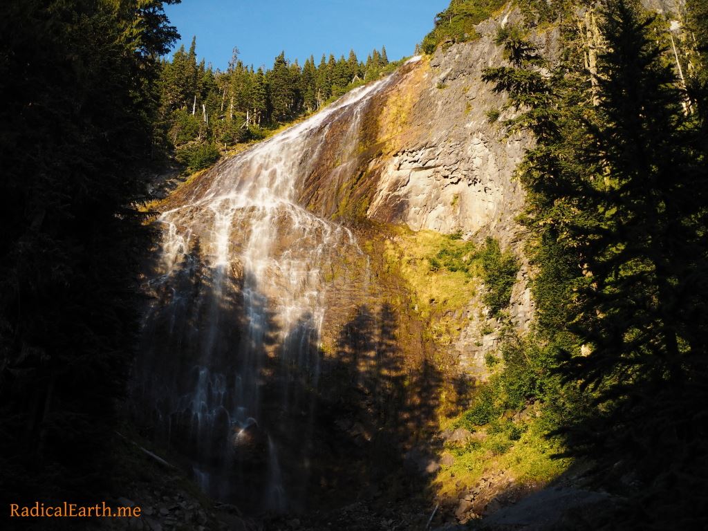
The weather held throughout the day, and we enjoyed some fantastic views of the Mountain. It was hot enough that a quick soak below Spray Falls was in the cards! We ended our day at Eagles Roost camp.
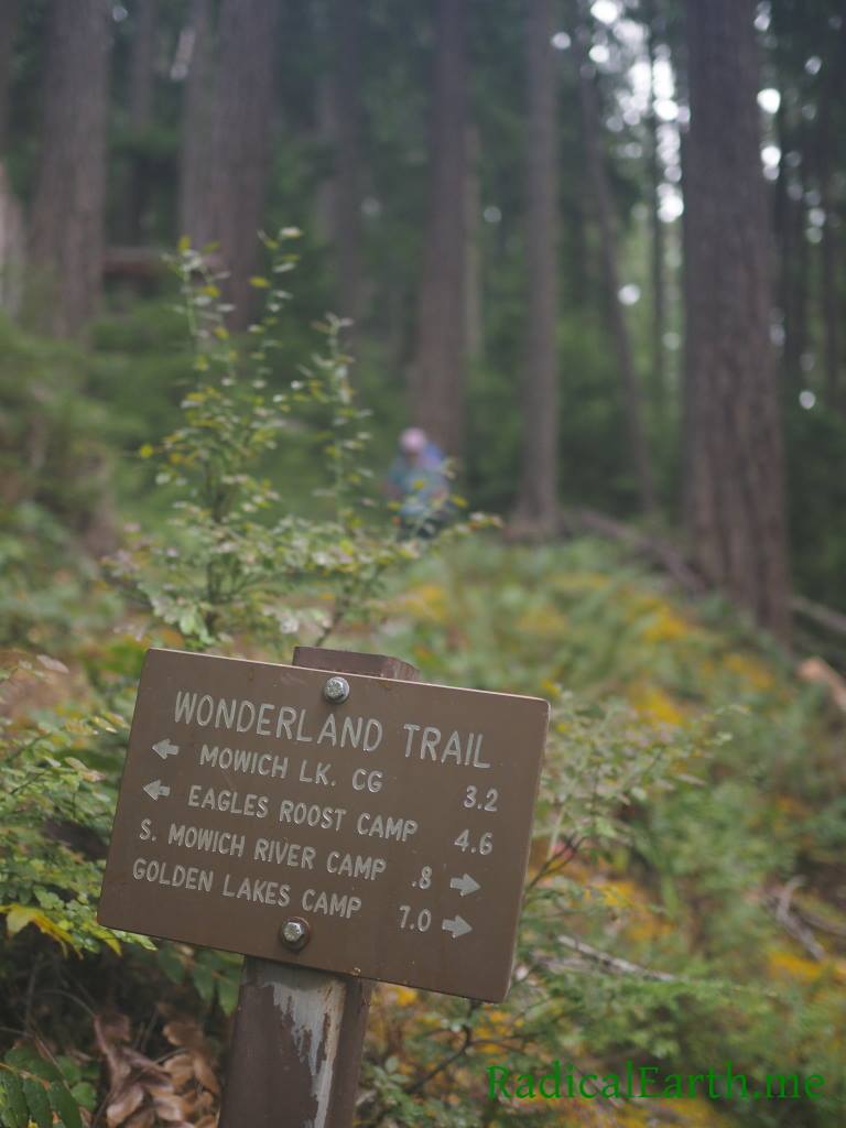
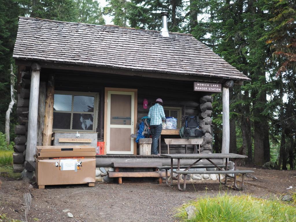

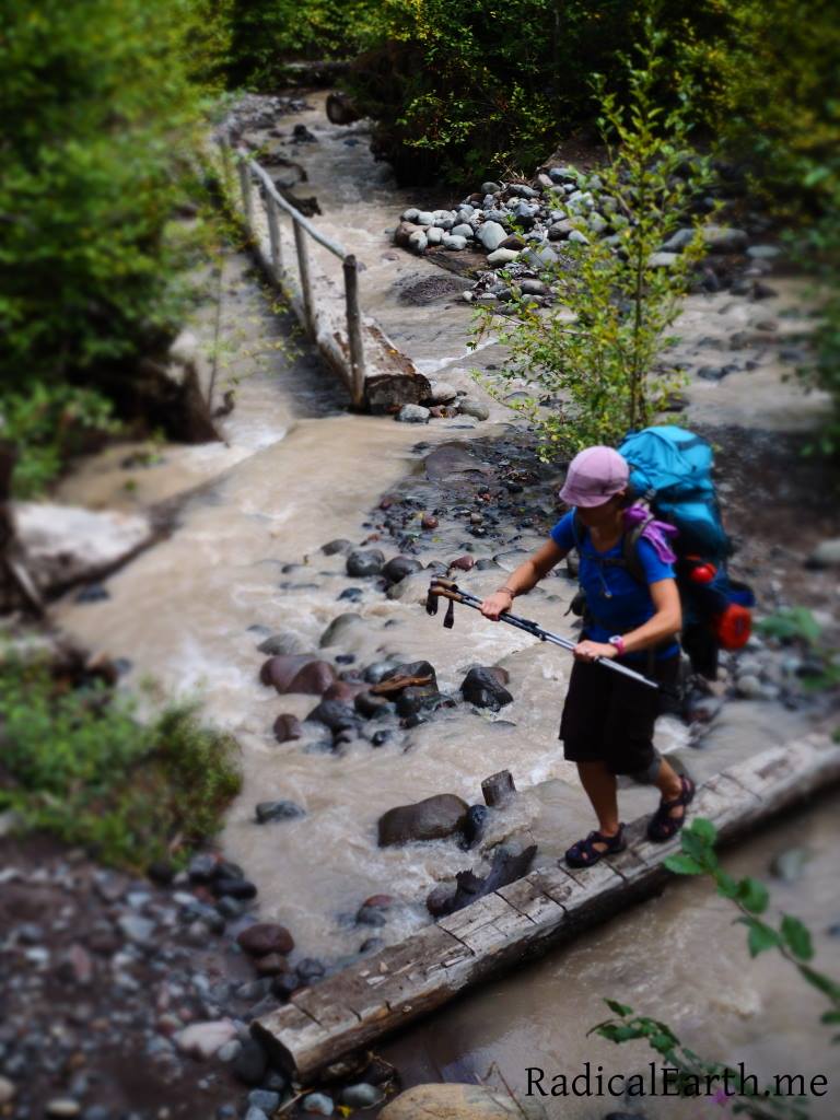
Day 3 started out light, light packs that is! Food cache locations are set up perfect for hikers setting a solid, early to rise, most of the day hike, but not setting speed records. Our resupply points were a three day hike away. So day three was a LIGHT pack. It was not far to Mowich lake from Eagles Roost where our first food cache was waiting, but the few miles with “feather” light packs felt great. The Sunny weather had been replaced with overcast, and light passing rain, so having a covered porch while we sorted our packs was nice. We didn’t have much time to linger, as we had a 9 mile hike from the Mowich river basin to the Golden Lakes Ranger station and campground. Navigating the South Mowich river with its multiple flood channels and sketchy log bridges proved fun, but ate more time than we expected.
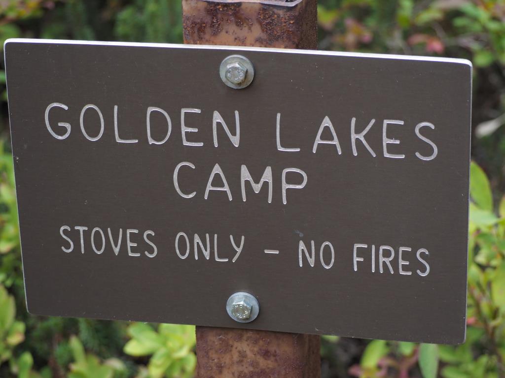
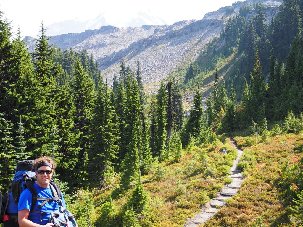
It had been a very dry Summer and we were notified to be extra judicious with our water use and refilling as many normally year round springs had dried up. Ground hornets were also prolific in spots due to the heat, and lack of rain. The warnings proved valid, and we were glad to find a nice spot past the South Mowich river to water up before we made the 6 mile hike up to Golden Lakes. The vertical elevation upto Golden Lakes clocked in at 2,300 ft, and it proved to be a long and difficult hike. Full weight packs after our resupply added to the strain. My wife counted this as one of her toughest days. I was in high gear the whole day, and felt great! My trail day reckoning was coming, and very soon. Towards the top of the climb we were rewarded with view of the Mountain, the Mowich basin, and excellent views across the valley towards a section of Spray Park and Spray falls. Golden Lakes was a delightful spot, and we had a chance to chat with the Park Ranger, and learned we all attended the Evergreen State College.
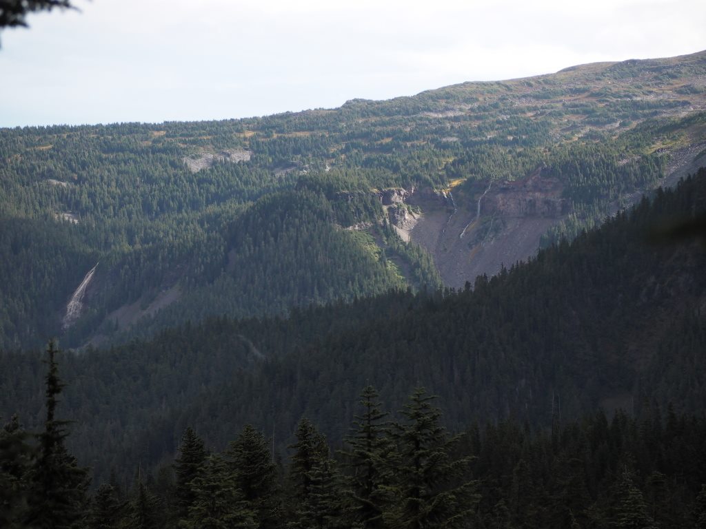
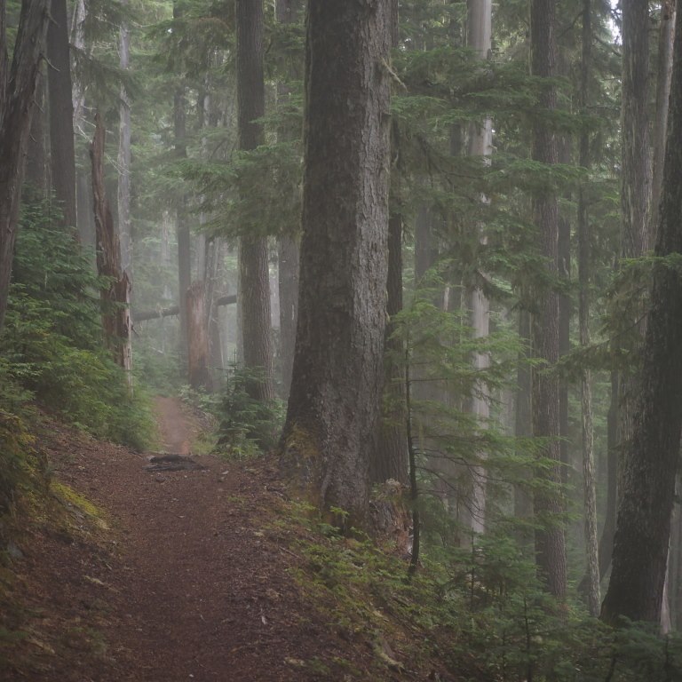
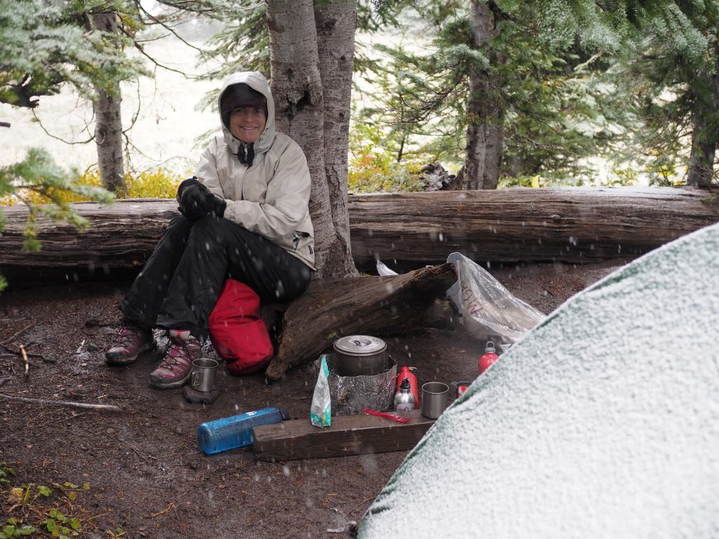
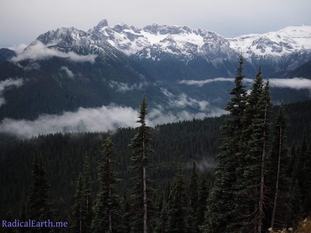
Day 4 we were awakened by steady rainfall. The first moderate rain of the trip. Even though it was the end of August, getting so many blue sky days in a row at Rainier was a real treat. We enjoyed our hot coffee and oatmeal and broke camp to make our way to Klapatche Pass and our night 4 camp. Clouds enshrouded much of the Mountain throughout the day, but we still were able to see impressive features near the trail, and at distance. The shoulders of Sunset Park pictured above offered some breathtaking views of rugged high country with massive volumes of water crashing out of the glaciers just out of view in the clouds. The rain picked up in intensity as the day went on. As we approached the North Puyallup bridge, it was in downpour territory, a true wetting rain. Fortunately we had pockets of old growth trees to wait out the heaviest downpours. I realized at that point that somehow, I had neglected to pack an appropriate water proof bag for my sleeping bag. Upon inspection under a tree I realized the error in my ways. Fortunately my wife had an extra trash bag in the bottom of her pack. The trash bag was better than nothing, though I knew that until the next sunny day I would have a wet bag on my hands which created a growing malaise in my mind. The North Puyallup river and bridge is a powerful spot, with a constant pounding of glacial water crushing under your feet. In the video linked above, you can see the water emerging from Tokaloo Rock, which is a mountain anywhere else, but behind the peak of that mass of rock is the sprawling Puyallup glacier, and of course The Mountain itself. From the North Puyallup to Klapatche Pass, it is only a couple miles, but it all happens in 2,100 vertical feet. Upto this point the trail had been as meticulous as one can expect in a National Park. Our luck ran out as this section is known for fast growing brush, and the rangers struggle to keep up with the lopping. This made for an even wetter wetting rain as every inch of our bodies were constantly assaulted by water as we crashed through the brush. Once we made it to camp the rain was now accompanied by wind. I was officially in “cracked” mode, mustering enough action to get the tent set up, hang our food on the bear poles, and retreat to our tent. My wife had a great day despite the rain, and kept her cool ( I did not) even while the rain fly kept blowing out of our hands multiple times during set up. She even prepped up hot water and cocoa to warm our bones. I had left our flask of whiskey at Golden Lakes, so this only added to my bad attitude. More whiskey would have to wait for re-supply. All I could muster was sulking on my wet sleeping bag! It turns out, that days rainfall broke the record for the most precipitation ever recorded at Mount Rainier in the month of August.
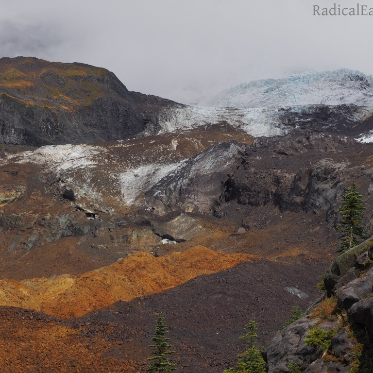
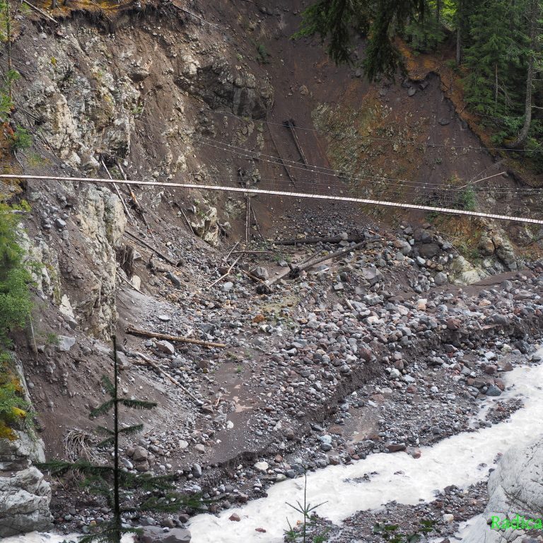
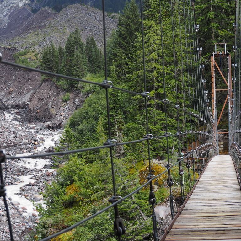
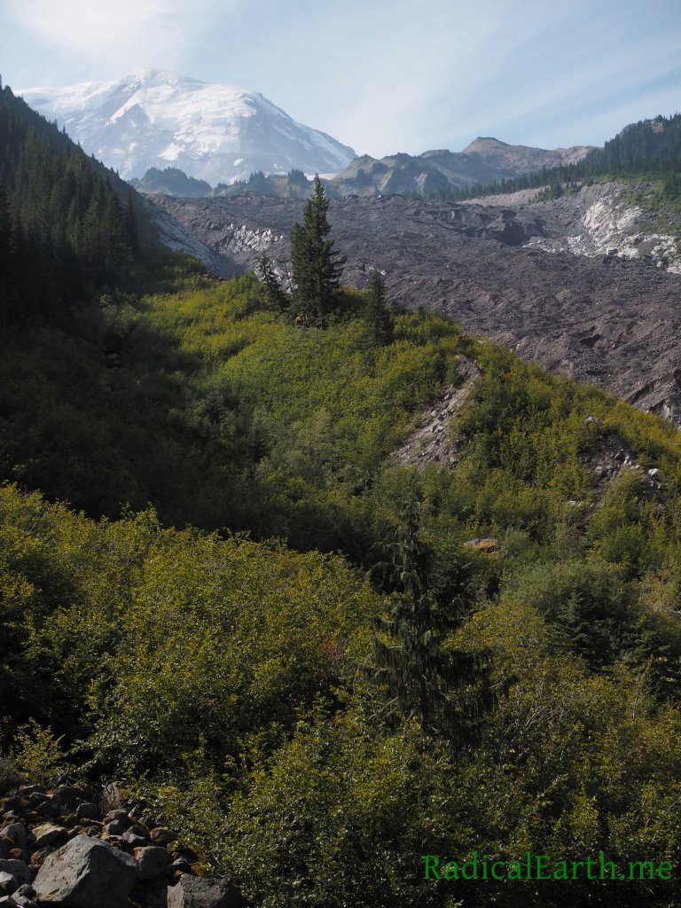
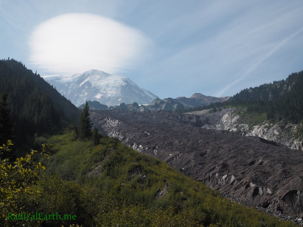
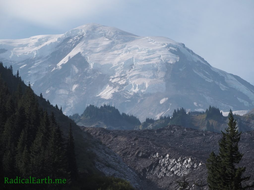
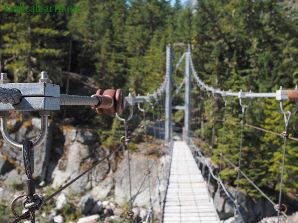
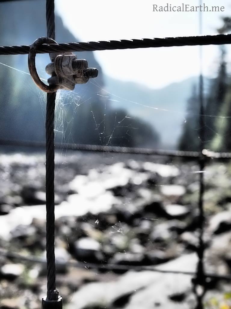
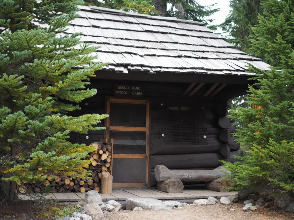
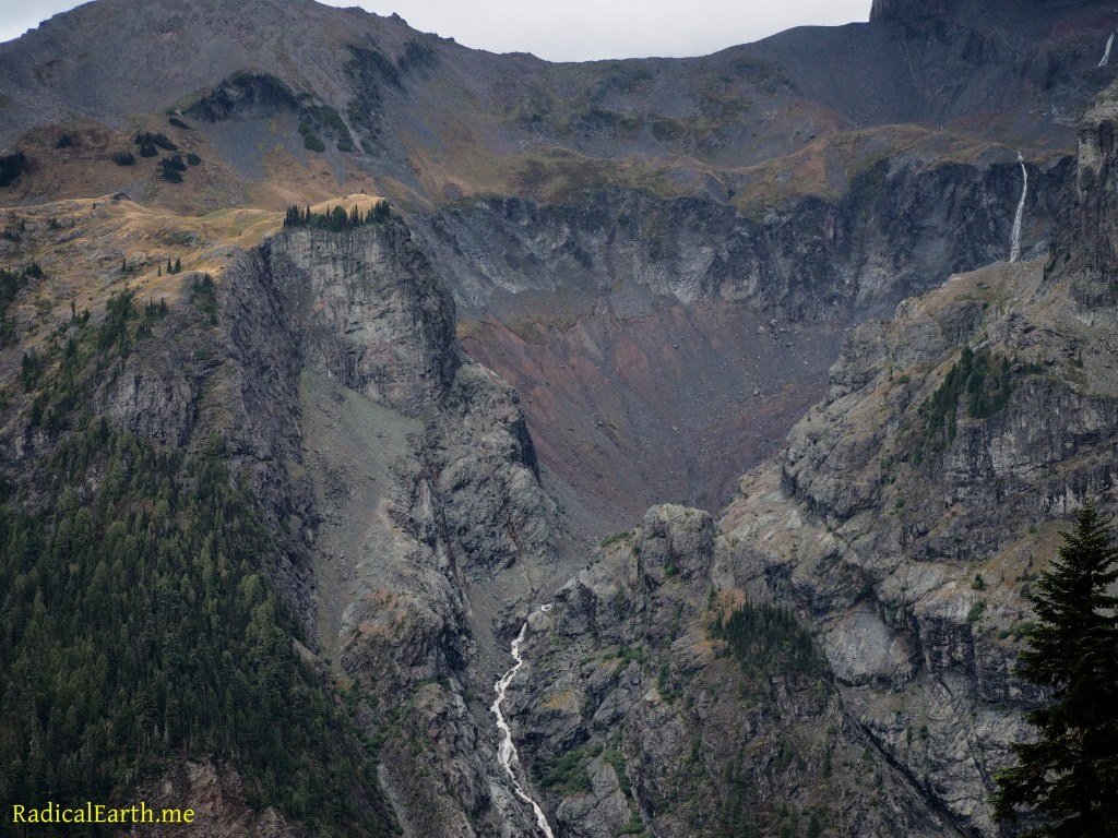
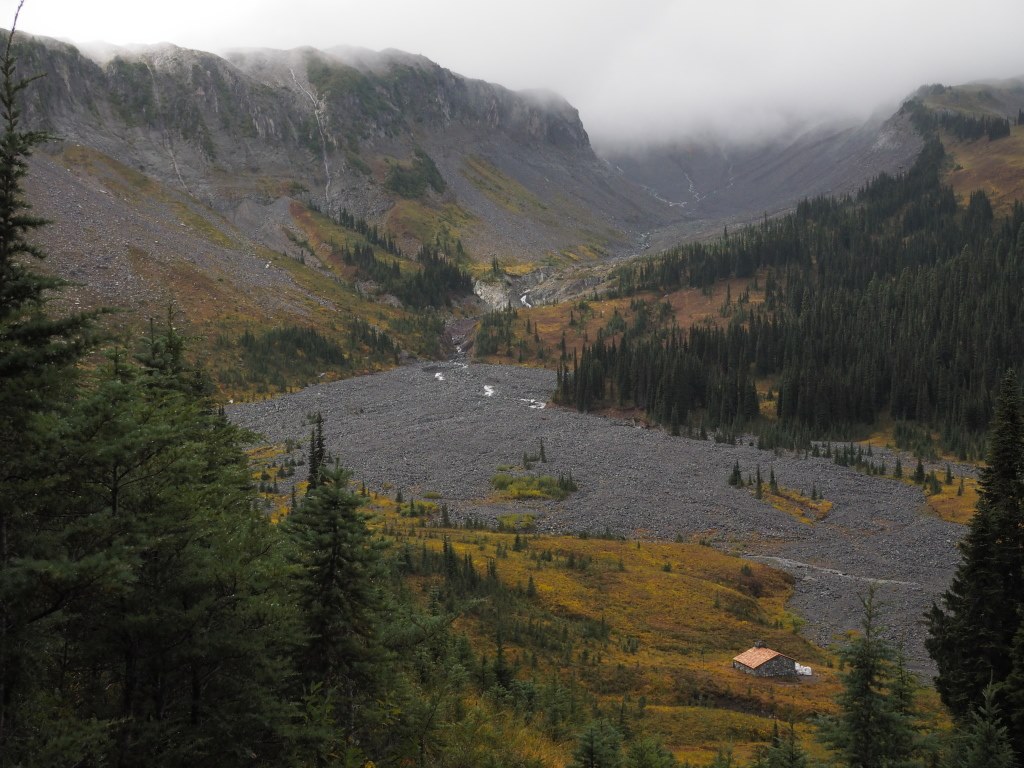
Day 5 started out dry. Hooray! Breaking camp and stuffing everything back in your pack is a drag when it’s raining. The rain didn’t take long to move back in but it was less intense than the previous day. Our upcoming day on the trail would involve 11.2 miles and 3,400 feet of elevation gain, and 2900 feet of loss. Big day ahead! Though the Mountain remained shrouded in clouds, the stunning volcanic rusty red, purple and yellow rock of the Tahoma glacier basin afforded jaw dropping views. Nearly every glacier basin has large volume waterfalls emerging from the glaciers above, and as seen in the photo above (click on it) Tahoma is no exception. Raging water crashing down the jagged cliff faces on its own is impressive, however when the clouds cover the terrain above, it gives the illusion that the creeks are coming straight out of the mountain which is simply spectacular. The much anticipated Tahoma creek suspension bridge was also on the days list of sights to see, and it did not disappoint. Tahoma creek bridge is 150 feet long, and 200 feet above the lahar and flood carved creek basin below. I previously jumped out of airplanes for a living, and climbed large trees professionally, despite that resume this bridge offered an adrenaline rush I was not expecting. Once past the massive Tahoma glacier basins, the trail leads you back up to the sub-alpine, wonderfully situated Indian Henry’s Hunting Ground. We were running out of daylight, and the rain was picking up, so we did not take any extra time to explore this area and instead made haste to our nights camp at Devils Dream tucked away in the upper elevation of Rainier’s impressive West side old growth forest. We ran into a Park ranger on the trail near Indian Henry’s, and asked about Devils Dream, specifically if we should expect a packed camp. He said the reservations showed camp full, but curiously he mentioned that with the rain he expected it would be empty. “Empty?”, I questioned. “Even so close to Longmire Ranger Station and the West-side road?” I queried further. He went on to explain that the rain drives off nearly all day hikers, and even scuttles large numbers of Wonderland permit hikers. Hard to comprehend for us, with all of the effort that goes into this trip, to be turned back by rain, even soaking, cold, miserable rain. He was right, we were rewarded with a completely empty Devils Dream camp to enjoy, and a rain-less evening to boot.

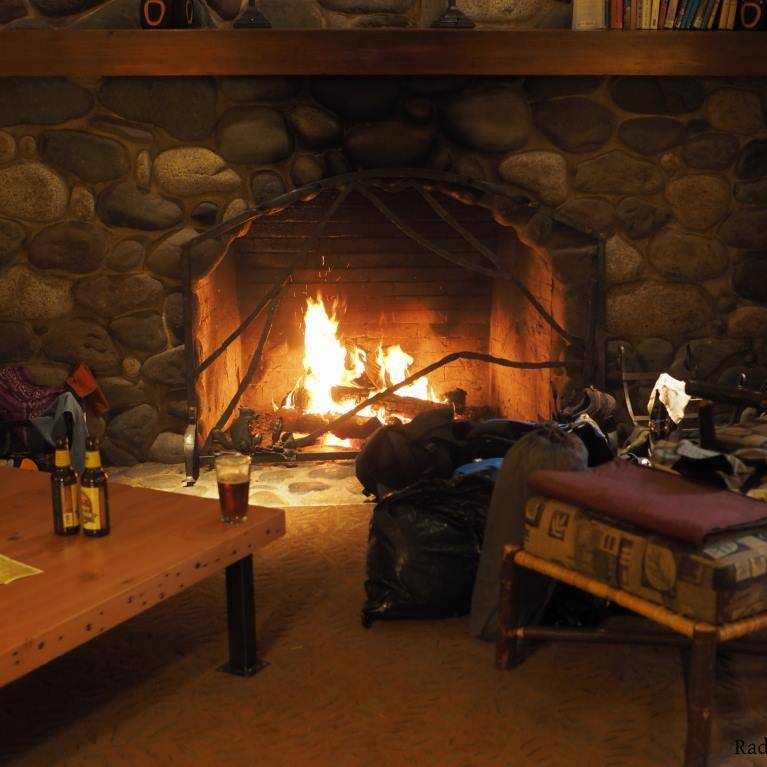
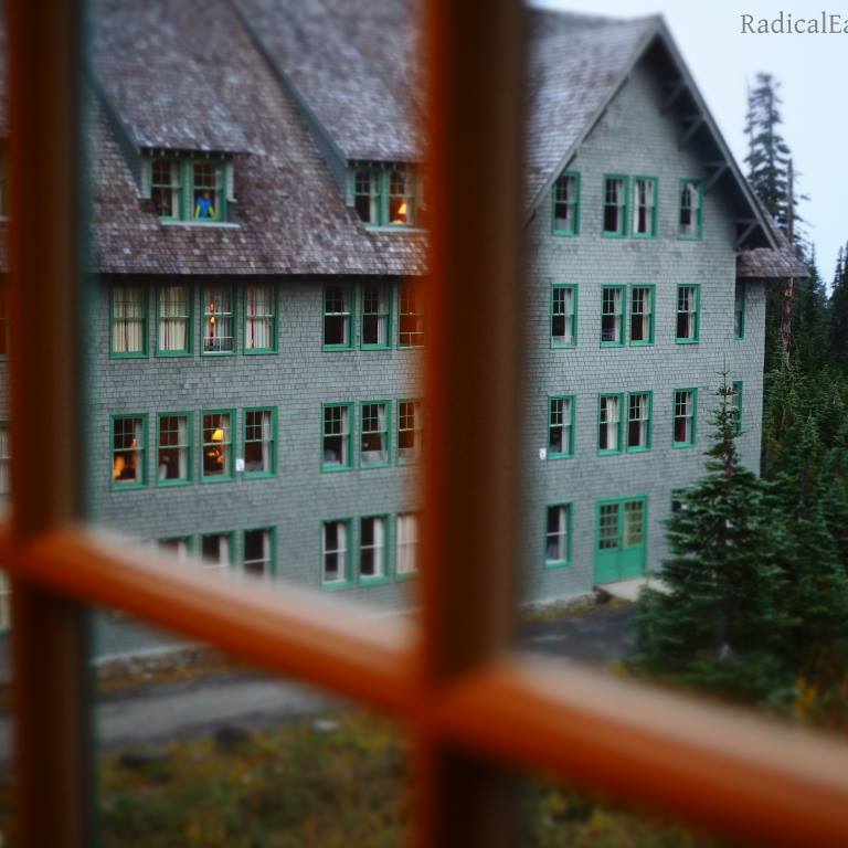
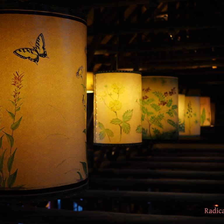
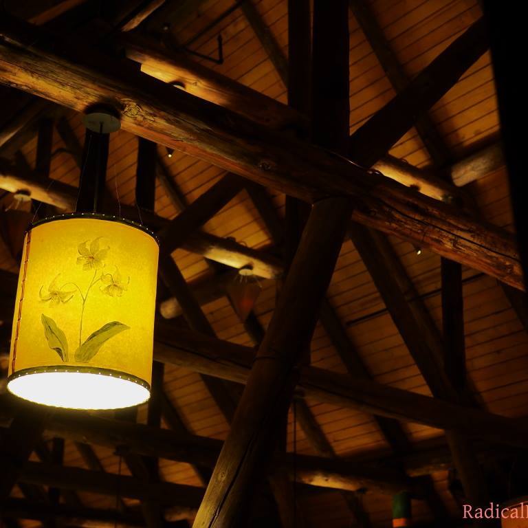
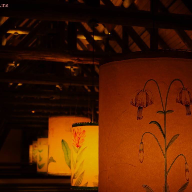
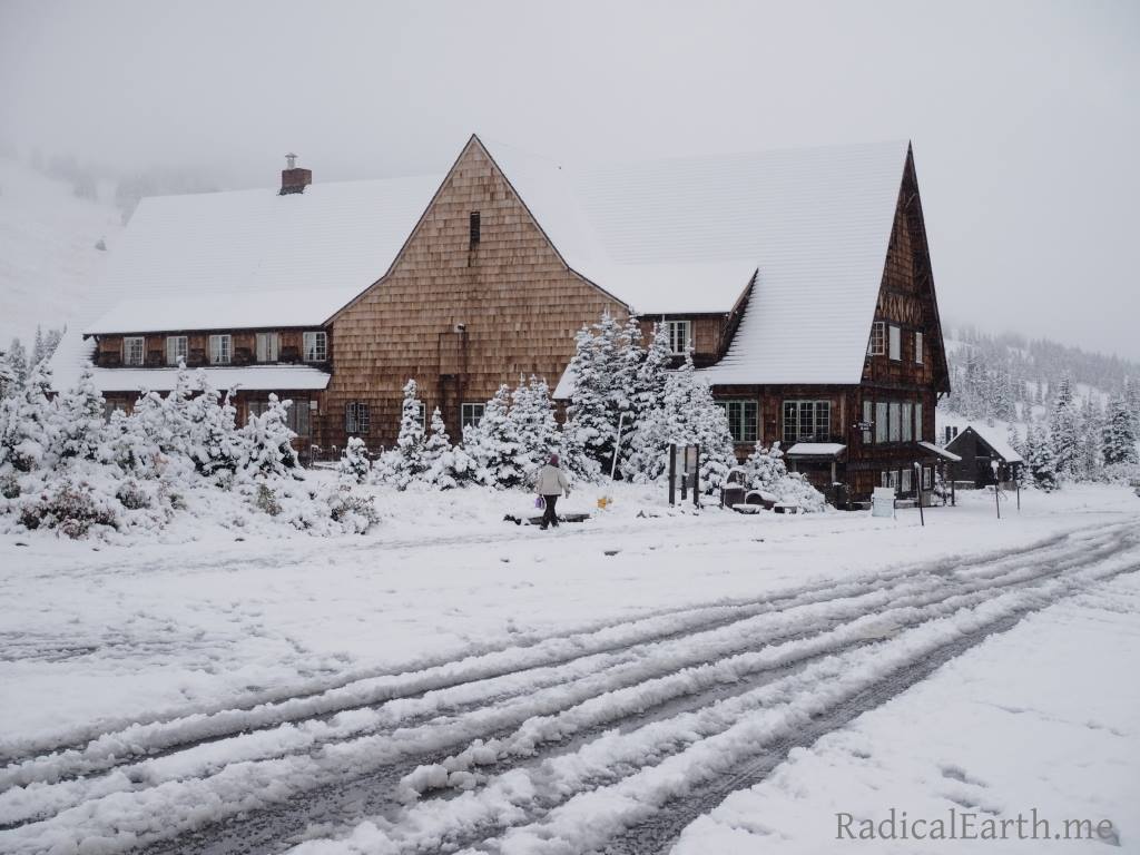
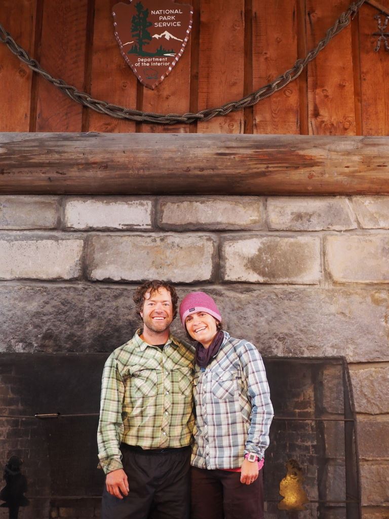
Day 6 would bring our soaked to the bone bodies into Longmire, where our third and final re-supply cache was waiting for us. The day involved 5.5 miles of almost entirely downhill hiking, 2500 feet through massive old growth Douglas Fir, Western Red Cedar and Maple groves. The last 2 miles follows a jumbled mess of past floods and lahars that have ravaged the respective drainage’s for ages. Walking into Longmire the days rain had subsided, and our packs were light, floating our spirits some, but when we went into the lower lodge, ordered a burger, fries and a cold Mirror Pond Pale Ale and sat in front of the crackling fire, gear strewn steaming and drying, we suddenly were pining for a night at the hotel up at Paradise Inn. We had resisted the thought of abandoning the trail for a night, planning to camp at the Paradise River camp. Wet to the core, cold, and teased with a idea of a warm bed, we cracked! After retrieving our last food cache from the Ranger station, we called up to the Paradise Inn, and after a little finagling we booked a room. It is no slouch of a hike from Longmire to Paradise. We chatted up some of the staff at the Longmire lodge, and we ended up hitching a ride with a cook at the end of his shift. This was an out of the way drive up the mountain to Paradise for our friendly local taxi. He refused our cash tip, and instead asked us questions about our hike and told us stories of his favorite local hikes, and the nearby logging traditions and outdoors mentality. Even though we would lose one night of serene and quite wilderness experience, it was fun to tour the Paradise Inn, scour the old photos and historic blurbs on the wall, play a board game, drink some more beer and DRY OUR GEAR in our little room.

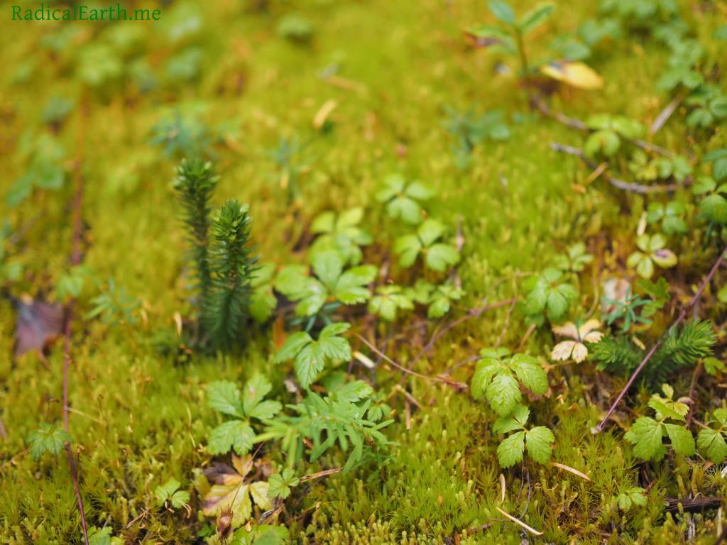
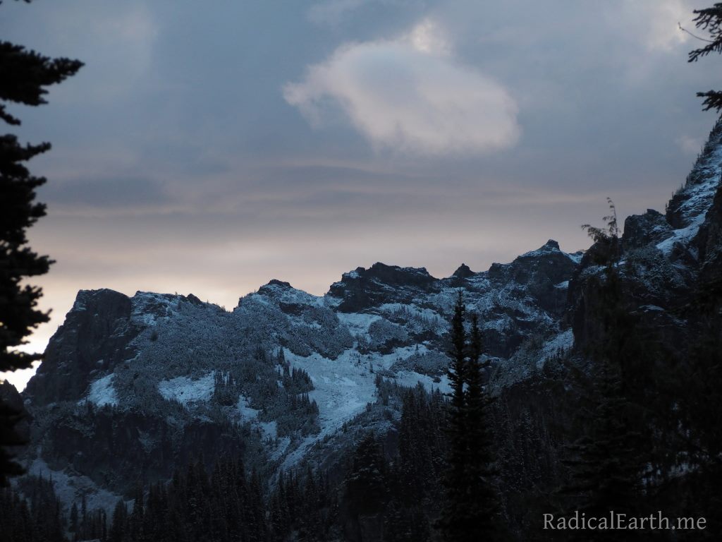
Day 7 we started out with dry gear and a filling breakfast at the Paradise Inn cafeteria. Lucky us! Our next camp would be at Maple Creek, and we were able to utilize the High Lakes trail from Paradise to tie back into the Wonderland. The weather was shifting to colder, but the forecast called for less precipitation. After 2 days of the Mountain blanketed with thick clouds, we were once again given an opportunity to view the high flanks. The sky was overcast, and though this muted much of the surrounding scene the grey and white view of the Mountain with an almost black silhouette of the tree’d ridge line in the foreground was a special sight. One of the spectacular experiences of the Wonderland Trail is simply walking around the Mountain, which looks different every day as you make your way down the trail. New ridges and glaciers come into view. The Maple Creek area is entirely below sub-alpine, and offers up lower elevation flora and fauna to observe, which was a nice change.


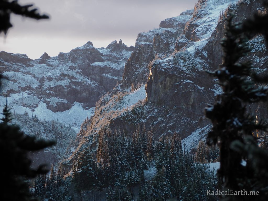
Day 8 would take us from Maple Creek camp all the way up to Indian Bar. Nearly 11 miles and 3000 ft of vertical climb. It proved a worthy day. 45 minutes from camp we made sure to utilize a top notch bathroom facility at Box Canyon on the Stevens canyon road, complete with warm running water and hand dryers (it’s the little things). A facility that was much easier to appreciate than the decomposing toilets at Maple Creek. Views into Box Canyon just across the road happen to be incredible too. From Box Canyon the slog began. A long, steep trail tucked primarily in the trees with little views beyond, for hours, which added to the perception of distance in our minds. Many switch backs eventually lead you to the impressive Cowlitz Divide, a large high ridge that begins to bring you above tree line, and on clear days affording what are reported to be some of the most satisfying views of the Mountain. Alas, this is Mount Rainier, and views were hidden behind thick banks of clouds. Small peekaboo’s of the Mountains flanks would reveal themselves through-out the day, and other amazing lower elevation views of magnificent natural features were available to take in. Once you make the Cowlitz Divide, the trail continues up, steep at times eventually becoming mostly sub-alpine. It had become a slight struggle for my wife that day, and understandably. It was long way, with some of the more rugged trail with serious elevation to be gained. The Cowlitz Divide seemed to just keep going, on and on. The views only increased as we continued up which helped with the boosts of adrenaline needed to just keep pushing over that next little ridge, only to discover it was just another of many “false summits”. One half mile out from our camp, we were finally afforded sweeping views of Indian Bar, and all of our hard work instantly had a satisfying closure in sight. Though shrouded in clouds, the surrounding basin is incredible. Walking into camp the trail leads you down a long, sturdy and to be admired staircase built by Park staff to help control erosion. Once to camp the trail leads you to the narrow, deep, and energizing Wauhaukaupauken Falls. Though cloudy, the day had been dry. There was sign of serious water flowing through our tent site in a previous storm, so we crossed our fingers, popped up our tent, whipped up some hot cocoa with whiskey and enjoyed dinner surrounded by this wonderful high elevation country.


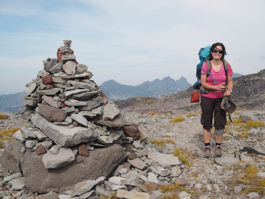
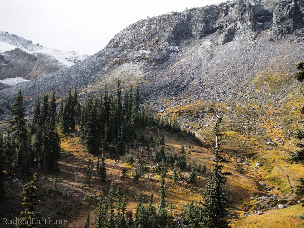
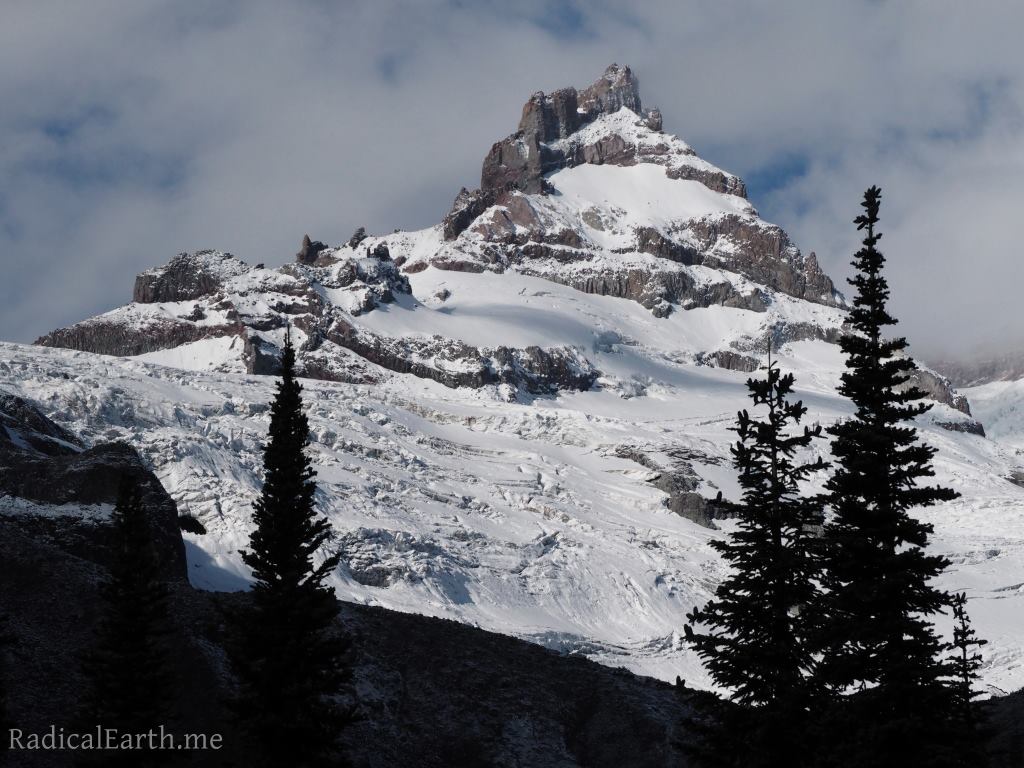
Day 9 started out chillier than we had experienced yet. It had rained lightly over night, but no problems with water flowing into our tent, and it was not raining when we awoke for our routine of coffee, oatmeal, and tent breakdown. Our system for camp breakdown and deployment were dialed in by this time many days ago. The first couple of days were a bit of a mess, but now it was quick and efficient. I found that lingering for another coffee like I might have considered at the start of the trip had shifted to get everything in your pack as quickly (not crazy rushing) as you can, and hit the trail. Camp is nice, but the TRAIL, that is where I wanted to be, and for essentially the entire day, that is where you are. Hiking, stopping for a snack, slowing down for a striking panoramic of nature at its finest, and then off again down a never repeated piece of ground. Every step is unique. With the cooler temps it was no surprise once we set off on the trail and gained a few hundred feet, that we discovered snow on the trail. Certainly no surprise in the high country of Rainier at any time of the Summer, but it did settle us into a reality that we may have more coming, including through the stunning Ohanapecosh Park further up, and the notoriously snowy Panhandle Gap. The day proved to be straightforward, and though the Mountain still remained encased in clouds, the views as we approached Summer Land were incredible. A pocket view of a cloud encased nearby rocky peak known as K-Spire is one of my favorite images from our hike. We set up camp quickly, hung our food, and watched a snowy squall push in. Good thing we had our hot cocoa and whiskey ready!


Day 10 and our last day on the trail, and what a day it was! We awoke to crisp blue skies and clear, stunning views of the summit, Emmons glacier and Little Tahoma Peak. Emmons glacier has the largest surface area of any glacier in the lower 48 states of the USA. Our day would consist of 10.3 miles ,2,400 feet vertical elevation lost and 2,100 vertical feet gained on our way to Sunrise and our little black Toyota. Once we broke camp we made our way down the trail into the Frying Pan Creek gorge, stunning views of the Cowlitz Chimneys were one our many visual prizes of the day.
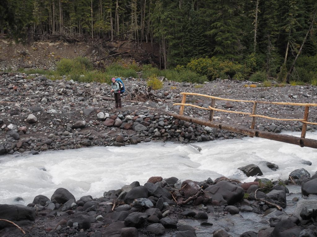
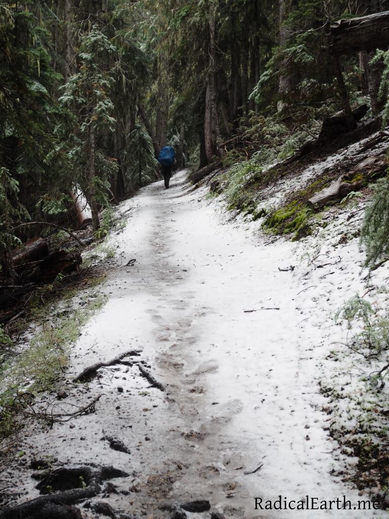
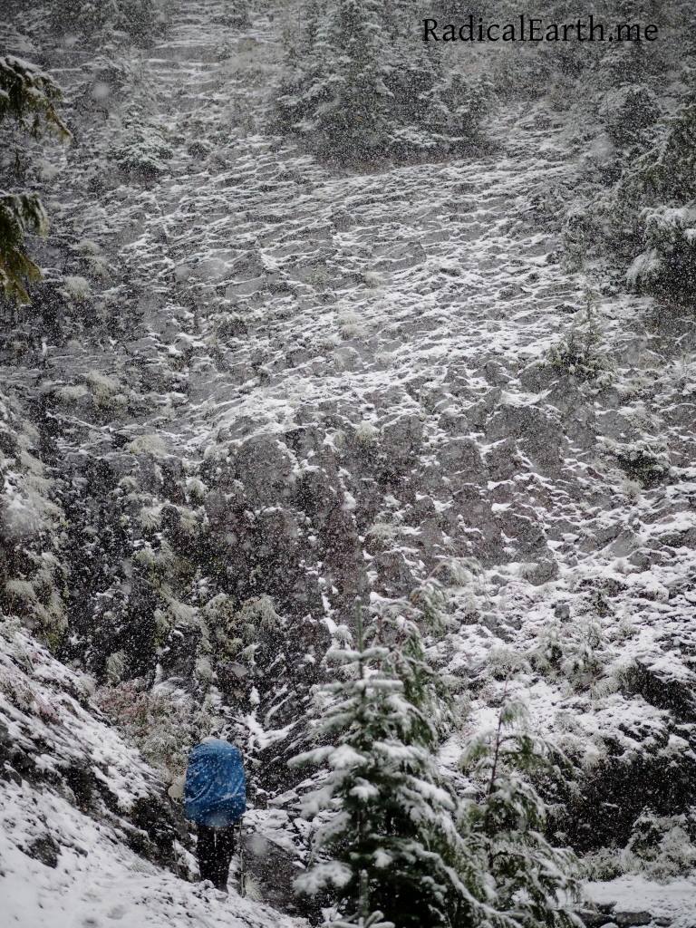
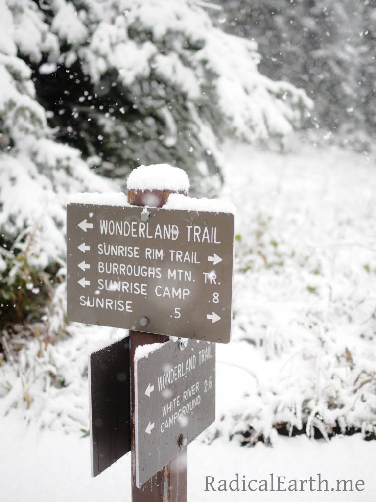
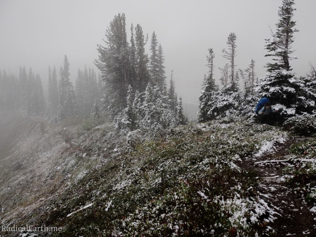
As we made our way across the White river, the spot we had car camped the night before we set off on the trail, and only 4 miles from the end of our hike at Sunrise, the mix of emotions of the trip nearing the end, the excitement of the accomplishment, the apprehension to leave such a wild place all went away when it started to snow, and snow really hard! A stark reminder of how quickly weather can turn on Rainier, and a reality that brought my mind right back to the matter at hand, the trail. By the time we reached the Sunrise Ranger Station it had snowed nearly ten inches. The storm had caught the Rangers just a bit off guard as they were only expecting a couple of inches to accumulate. In the 10 days we spent on the trail we had perfectly clear blue skies, warm days and even hot days. Smokey haze, shifting to the most rain ever recorded in August. Comfortable cloudy conditions with little precipitation, to cold, light snow, blue sky again, ending with 10 inches of wet heavy snow. Fitting conditions for a mountain of legend like Rainier/Tahoma.
I can’t be sure if I’ll make the circumnavigation of one of the worlds iconic volcanoes again, but I feel grateful to have the memories of the moments in time my wife and I hiked the 93 miles of the Wonderland Trail.
